 |
Fogo: The Caldeira of Fogo seen from the Airport |
Album Overview
Photo Index
  |
|
More photos in the vicinity: Embarking the Airplane to Praia Brava seen from the Airport Island of Brava seen from Fogo |
 |
|
|
Date: Nov 22, 2007 Longitude: -24° 29.12' Latitude: 14° 53.31'  
Show Photo Position in Google Maps |
||
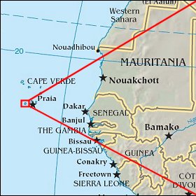 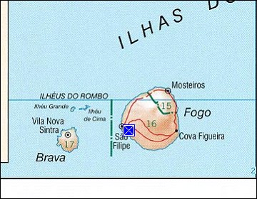 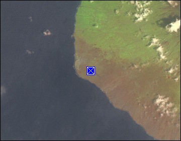 Map references: left: courtesy CIA, middle: courtesy US LoC Map Collection, right: courtesy NASA. This page has been updated on: 2011-Jul-28 |
||