 |
Gran Canaria: Cueva Grande |
Album Overview
Photo Index
  |
|
More photos in the vicinity: Roque Bentaiga and Pico de Teide Volcanic Erosion Valley of La Culata |
On a clear day the view from the mountains in the center of Gran Canaria is spectacular. From the terrace fields around Las Lagunetase one can see all the way down to Las Palmas. |
|
|
Date: Nov 23, 2004 Longitude: -15° 34.37' Latitude: 27° 59.08'  
Show Photo Position in Google Maps |
||
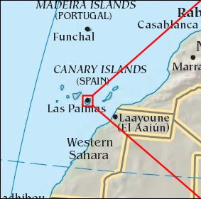 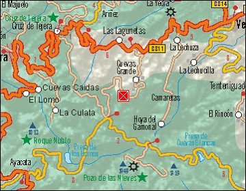 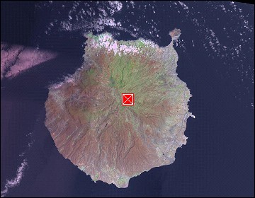 Map references: left: courtesy CIA, middle: courtesy Cicar, right: courtesy NASA. This page has been updated on: 2007-Nov-08 |
||