 |
Andes: Buried Road in Valle de Calingasta |
Album Overview
Photo Index
  |
|
More photos in the vicinity: Valle de Calingasta Valle de Calingasta Valle de Calingasta |
Heavy thunderstorms have caused a landslide which buried the road in the Valle de Calingasta. Downpours as this one are extremly rare in this dry region. |
|
|
Date: Feb 11, 2004 Longitude: -69° 40.49' Latitude: -31° 52.14'  
Show Photo Position in Google Maps |
||
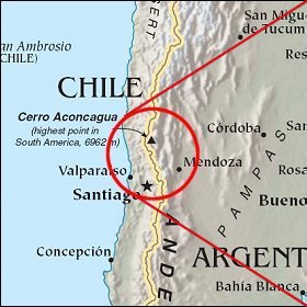 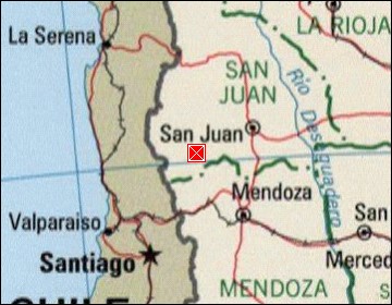 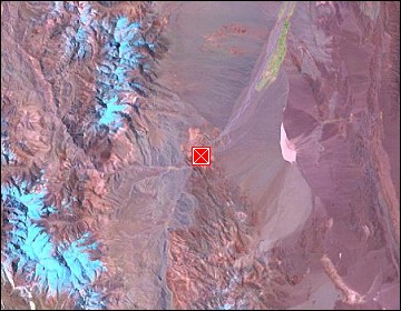 Map references: left: courtesy CIA, middle: courtesy LOC map collection, right: courtesy NASA. This page has been updated on: 2007-Nov-07 |
||