 |
Praslin: The Southern End of Praslin |
Album Overview
Photo Index
  |
|
More photos in the vicinity: Marina in Baie St. Anne La Digue seen from Praslin Anse Consolation |
The southern bay of Praslin, called Baie St. Anne, is a natural harbor. |
|
|
Date: Jän 25, 2007 Longitude: 55° 46.44' Latitude: -4° 21.28'  
Show Photo Position in Google Maps |
||
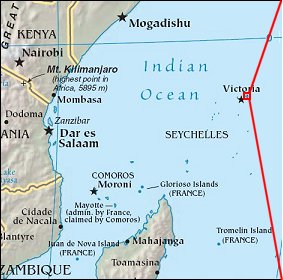   Map references: left: courtesy CIA, middle: courtesy US LoC Map Collection, right: courtesy NASA. This page has been updated on: 2007-Nov-08 |
||