
|
Photos - Helgoland (Germany) |
|
Helgoland is a tiny island in the North Sea (about 1.7 km2, 1600 inhabitants), which is special in many ways. Helgoland, a former posession of Denmark and Great Britain nowadays belongs to Germany and was heavily fought over during World War II. After the war the then uninhabited island was used as a bombing range, forming parts of the island (Mittelland) by one of the biggest non-nuclear explosions ever.
Helgoland is unique in its geology: the main island's characteristic red sedimentary rock in the middle of the German Bight is the only such formation of cliffs along the continental coast of the North Sea. These cliffs are home to thousands of birds, of which the guillemots are known best for their spectacular jumps into the sea.
|
|
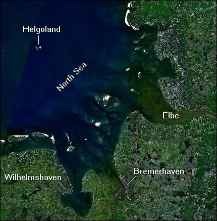 Here you see Helgoland from space. Image courtesy of NASA WorldWind. |
Bird's-eye View Cliffs Lummenfels Eurasian Oystercatcher Northern Gannet Common Seal Harbour Parish Church Nikolaikirche Leuchturm - Oberland Lange Anna Close-up of Lange Anna Unterland Unterland and the Dune Island Hummerbuden Unterland seen from the Harbour The Pier Landing Place The Dune Island Helgoland Airport Lighthouse on the Dune Island Public Telephone |