 |
Lower Austria: Landscape near Burgstall |
Album Overview
Photo Index
  |
|
More photos in the vicinity: Landscape near Burgstall Landscape near Burgstall Raised Hide near Johannesberg |
 |
|
|
Date: Oct 18, 2003 Longitude: 15° 56.65' Latitude: 48° 12.51'  
Show Photo Position in Google Maps |
||
 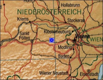 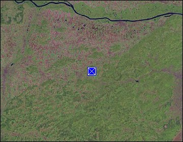 Map references: left: courtesy CIA, middle: courtesy LOC map collection, right: courtesy NASA. This page has been updated on: 2011-Jul-29 |
||