 |
Lower Austria: Governmental District of St. Pölten |
Album Overview
Photo Index
  |
|
More photos in the vicinity: River Traisen Klangturm in the Governmental District of St. Pölten Klangturm of St. Pölten |
The governmental district of St. Pölten has been built between the historic city center an the river Traisen in the 1990s after St. Pölten became the capital of Lower Austria in 1986. |
|
|
Date: Apr 08, 2007 Longitude: 15° 38.06' Latitude: 48° 11.91'  
Show Photo Position in Google Maps |
||
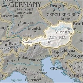
   Map references: left: courtesy CIA, middle: courtesy LOC map collection, right: courtesy NASA. This page has been updated on: 2011-Jul-29 |
||