 |
Dornbirn: Parish Church St. Sebastian |
Album Overview
Photo Index
  |
|
More photos in the vicinity: Church of Hatlerdorf Parish Church St. Sebastian Hatlerdorf seen from Zanzenberg |
 |
|
|
Date: Jun 09, 2006 Longitude: 9° 45.14' Latitude: 47° 24.48'  
Show Photo Position in Google Maps |
||
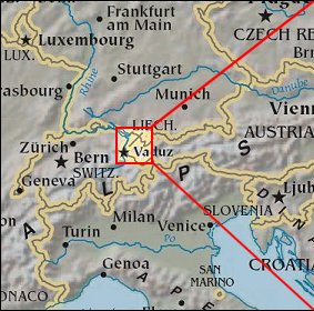 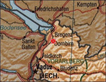 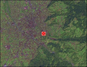 Map references: left: courtesy CIA, middle: courtesy US LoC Map Collection, right: courtesy NASA. This page has been updated on: 2007-Nov-07 |
||