 |
La Palma: Lighthouse at Punta Hoyas |
Album Overview
Photo Index
  |
|
More photos in the vicinity: Beach at El Remo Coast at El Remo Playa de Charco Verde |
 |
|
|
Date: Aug 16, 2007 Longitude: -17° 52.31' Latitude: 28° 33.62'  
Show Photo Position in Google Maps |
||
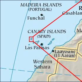   Map references: left: courtesy CIA, middle: courtesy Cicar, right: courtesy NASA. This page has been updated on: 2007-Nov-06 |
||