 |
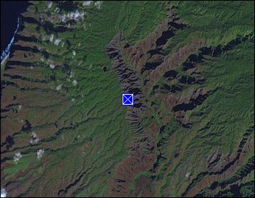
Hawaii/Kauai: Waimea Canyon III |
Album Overview
Photo Index
  |
|
More photos in the vicinity: Waimea Canyon Insight I Waimea Canyon II Waimea Canyon Insight II |
Due to the high amount of rain that makes Kauai one of the wettest places on earth, large parts of the canyons floor and its flanks are covered by tropical vegetation. This makes it a much more fertile place than its bog brohter along the Colorado river. |
|
|
Date: Dec 07, 2006 Longitude: -159° 39.70' Latitude: 22° 4.32'  
Show Photo Position in Google Maps |
||
   Map references: left: courtesy CIA, middle: courtesy US LoC Map Collection, right: courtesy NASA. This page has been updated on: 2011-Jul-28 |
||