


 Home
Home
China
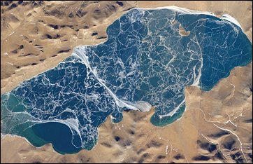 |
The alpine lakes of the Tibetan Plateau (China) are some of the most remote in the world. This mosaic of astronaut photographs, taken along a single International Space Station orbit track, depicts Lake Puma Yumco during the winter season..... ....read more |
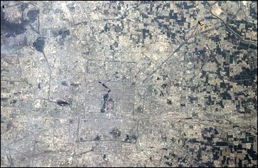 |
Beijing (China) has been one of the most important cities in the world for more than three thousand years - it first was named a capital city in 1057 B.C. This image of Beijing was taken from the Space Shuttle five
years ago (in late April-early May 1998), and is one of the best photographs of the city taken from orbit. ....read more |
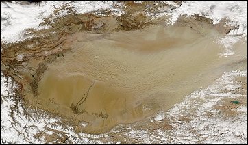 |
Plumes of dust were being pulled from the Tian Shan Mountains and across the Taklimakan Desert basin in western China on March 26, 2004, when the Moderate Resolution Imaging Spectroradiometer (MODIS) on the Aqua satellite captured this image. ....read more |
 |
Northeastern China’s Songhua River flows northward out of the Changbai Mountains and cuts across the Manchurian Plain before emptying into the Amur River, which separates northeastern China from Russia’s Far East. As China’s northernmost river system, the Songhua is an important artery for transporting agricultural products grown on the plain. ....read more |
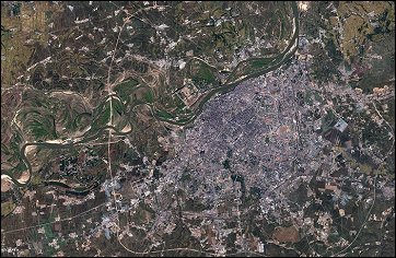 |
The Songhua River flows north out of the Changbai Mountains, cutting across the Manchurian Plain of northern China. As China’s northernmost river system, the Songhua is an important artery in transporting agricultural products grown on the plain. On its northward course, the river wends its way past Harbin, the capital of China’s
Heilongjiang Province, ..... ....read more |
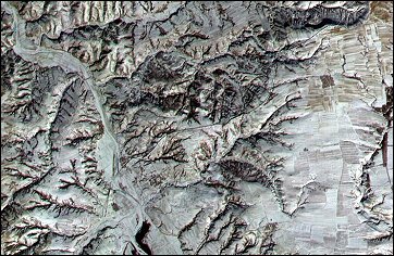 |
This image covers a 12 x 12 km area in northern Shanxi Province, China, and was acquired January 9, 2001. The low sun angle, and light snow cover highlight a section of the Great Wall, visible as a black line running diagonally through the image from lower left to upper right. ....read more |