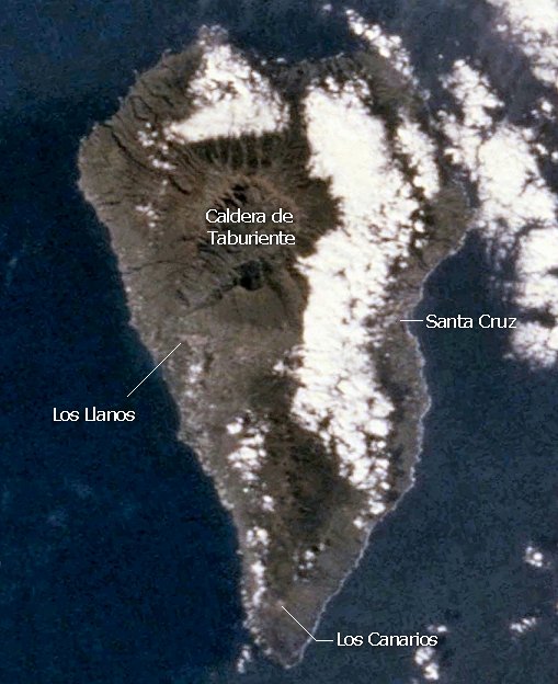
La Palma is one of the western islands of the Canary Islands. With an area of 700 km2 it is the third smallest of the seven main islands. La Palma was formed three to four million years ago as a seamount by volcanic activities like all of the Canary Islands. It rises 3500 m from the seafloor to the sea surface and reaches a height of 2426 m above sea level. 500,000 years ago the primary volcano Taburiente collapsed with a giant landslide which formed the Caldera de Taburiente.
If you are planning to visit La Palma you may be interested in having a quick look at several photos it. Click on the links below to view the pictures. We have taken any attempt to provide exact (GPS-based) coordinates of the positions where the photos have been taken.
Here you see La Palma from space. Image courtesy of Earth Sciences and Image Analysis Laboratory, NASA Johnson Space Center.