 |
Sal: Rifes da Pada |
Album Overview
Photo Index
  |
|
More photos in the vicinity: Shipwreck at the Coast near Pedra Lume Old Cableway at Pedra Lume Tunnel to the Saltworks |
 |
|
|
Date: Nov 23, 2007 Longitude: -22° 54.01' Latitude: 16° 45.53'  
Show Photo Position in Google Maps |
||
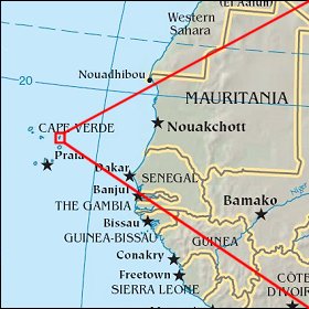 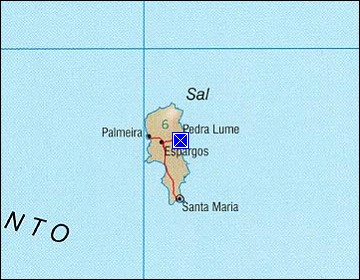 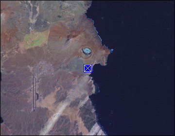 Map references: left: courtesy CIA, middle: courtesy US LoC Map Collection, right: courtesy NASA. This page has been updated on: 2011-Jul-28 |
||