 |
Chamonix-Mt.Blanc: Argentière Valley |
Album Overview
Photo Index
  |
|
More photos in the vicinity: Aiguille Verte Aiguille Verte and Mont Blanc Ascent to Aiguille d'Argentière |
A massive glacier tongue flows down the Argentière Valley. The white summit in the back is Mont Dolent |
|
|
Date: Jul 25, 2004 Longitude: 6° 57.73' Latitude: 45° 57.95'  
Show Photo Position in Google Maps |
||
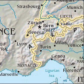 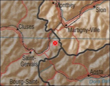 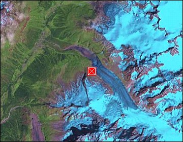 Map references: left: courtesy CIA, middle: courtesy US LoC Map Collection, right: courtesy NASA. This page has been updated on: 2007-Nov-07 |
||