 |
Andes: Private Property |
Album Overview
Photo Index
  |
|
More photos in the vicinity: Rio Blanco Barren Andes Rio Blanco |
 |
|
|
Date: Feb 13, 2004 Longitude: -69° 56.04' Latitude: -31° 54.33'  
Show Photo Position in Google Maps |
||
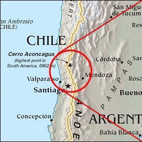 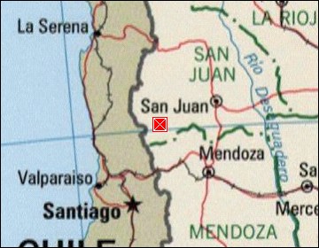 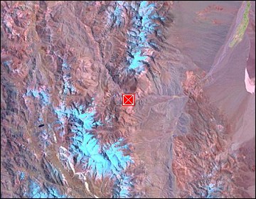 Map references: left: courtesy CIA, middle: courtesy LOC map collection, right: courtesy NASA. This page has been updated on: 2007-Nov-07 |
||