 |
Andes: Mercedario |
Album Overview
Photo Index
  |
|
More photos in the vicinity: Two Brooks fed by the Glaciers of Mercedario El Siete de los Ansilta A Copper Brook |
Although Mount Mercedario is still about 10 km away, the clear air at an altitude of about 4500 m gives you the impression that the summit is just an hour's walk away. |
|
|
Date: Feb 15, 2004 Longitude: -70° 1.85' Latitude: -31° 56.71'  
Show Photo Position in Google Maps |
||
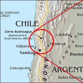   Map references: left: courtesy CIA, middle: courtesy LOC map collection, right: courtesy NASA. This page has been updated on: 2007-Nov-07 |
||