 |
Andes: Disappearing Penitentes |
Album Overview
Photo Index
  |
|
More photos in the vicinity: Penitentes Driving through Penitentes The Agua Negra Pass |
Disappearing Penitentes finally end up as cones of snow. |
|
|
Date: Mar 05, 2004 Longitude: -69° 48.27' Latitude: -30° 12.81'  
Show Photo Position in Google Maps |
||
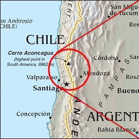   Map references: left: courtesy CIA, middle: courtesy LOC map collection, right: courtesy NASA. This page has been updated on: 2007-Nov-07 |
||