 |
Dubrovnik: The Entry of the New Harbor |
Album Overview
Photo Index
  |
|
More photos in the vicinity: Bridge over the Ombia Fjord MS Zuiderdam Harbor of Dubrovnik |
 |
|
|
Date: Aug 28, 2008 Longitude: 18° 4.76' Latitude: 42° 39.76'  
Show Photo Position in Google Maps |
||
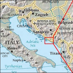 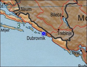 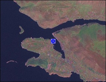 Map references: left: courtesy CIA, middle: courtesy US LoC Map Collection, right: courtesy NASA. This page has been updated on: 2011-Jul-29 |
||