 |
The Way of St James: Mont Tournier |
Album Overview
Photo Index
  |
|
More photos in the vicinity: Yenne Pierre Châtelle A Branch of the River Rhône |
Climb up to Mont Tournier - view onto the River Rhône below.  |
|
|
Date: Apr 25, 2007 Longitude: 5° 44.92' Latitude: 45° 42.24'  
Show Photo Position in Google Maps |
||
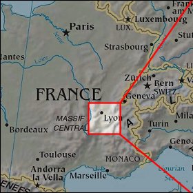 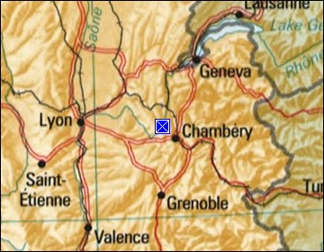 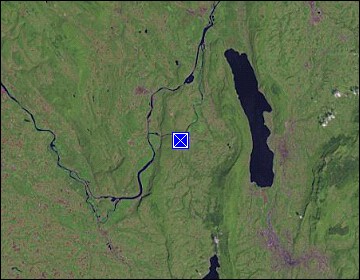 Map references: left: courtesy CIA, middle: courtesy US LoC Map Collection, right: courtesy NASA. This page has been updated on: 2008-Feb-21 |
||