
|
Photos - Gozo (Malta) |
|
Gozo is the tiny island west of Malta covering an area of about 67 km2, which is e.g. less than a sixth of the area of Vienna, Austria, or less than a 20th of the greater metropolitan area of London, UK. Despite its smallness, Gozo is worth a long stay, especially during spring time.
If you are planning to visit Gozo you may be interested in having a quick look at several photos of Gozo. Click on the links below to view the pictures. We have taken any attempt to provide exact (GPS-based) coordinates of the positions where the photos have been taken. |
|
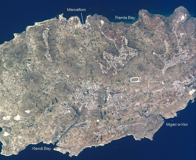 Here you see Gozo from space. Image courtesy of Earth Sciences and Image Analysis Laboratory, NASA Johnson Space Center. |
Fungus Rock Salt Pans West of Marsalforn Sandstone near Marsalforn Coast West of Marsalforn Northwest of Zebbug Tower in the Citadel of Victoria Ta'Pinu Inland Sea Azure Window Torri ta Xlendi Xewkija Mgarr ix-Xini with Comino in the Background Comino, Cominotto, and Malta seen from Gozo Xewkija seen from Ggantija Sanap Cliffs Sea of Yellow Flowers near Mistra Rocks Ramla Bay Xlendi Bay and is-Sanap Azure Window Xlendi seen from Above Harbour of Mgarr Ferry between Malta and Gozo |