 |
Upper Austria: Hofpürglhütte |
Album Overview
Photo Index
  |
|
More photos in the vicinity: Bischofsmütze Reißgangscharte Rötelstein |
Looking southwards we see the Hofpürglhütte. Far in the background (about 60 km away) we see the glaciers of Ankogel and Hochalmspitze. |
|
|
Date: Aug 01, 2007 Longitude: 13° 31.40' Latitude: 47° 29.37'  
Show Photo Position in Google Maps |
||
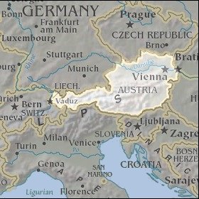   Map references: left: courtesy CIA, middle: courtesy LOC map collection, right: courtesy NASA. This page has been updated on: 2007-Nov-06 |
||