 |
Oman: Fort of Nizwa |
Album Overview
Photo Index
  |
|
More photos in the vicinity: Nizwa seen from the Fort Mosque of Nizwa seen from the Fort Fort of Nizwa |
The imposing fort has been built in the mid 17th century by Imam Sultan Bin Saif Al Ya'ribi. |
|
|
Date: Feb 22, 2010 Longitude: 57° 31.81' Latitude: 22° 56.01'  
Show Photo Position in Google Maps |
||
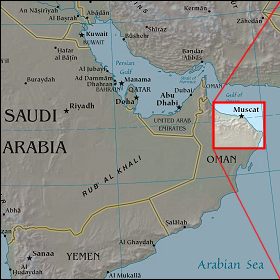   Map references: left: courtesy CIA, middle: courtesy US LoC Map Collection, right: courtesy NASA. This page has been updated on: 2011-Jul-31 |
||