 |
Helgoland: Unterland |
Album Overview
Photo Index
  |
|
More photos in the vicinity: Unterland seen from the Harbour Landing Place The Pier |
 |
|
|
Date: Jun 30, 2008 Longitude: 7° 53.47' Latitude: 54° 10.82'  
Show Photo Position in Google Maps |
||
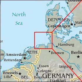 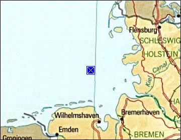 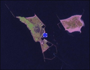 Map references: left: courtesy CIA, middle: courtesy US LoC Map Collection, right: courtesy NASA. This page has been updated on: 2009-Feb-23 |
||