
|
Photos - Gibraltar (United Kingdom) |
|
Gibraltar is a British overseas territory which is located near the southern tip of the Iberian Peninsula, overlooking the Strait of Gibraltar which links the Atlantic Ocean to the Mediterranean Sea. The territory shares a land border with Spain to the North. Gibraltar has historically been an important base for the British Armed Forces and is the site of a British naval base. Nowadays it is crowded by many tourists.
If you are planning to visit Gibraltar you may be interested in having a quick look at several photos of the area. Click on the links at the right to view the pictures. We have taken any attempt to provide exact (GPS-based) coordinates of the positions where the photos have been taken. |
|
| Gibraltar seen from La Linea - The Border to Gibraltar - Casemates at Gibraltar - Main Street of Gibraltar - House at Main Street of Gibraltar - Gibraltar City Hall - Gibraltar seen from Punta del Canero - Close-up of Gibraltar I - Close-up of Gibraltar II - Close-up of Gibraltar III - Close-up of Gibraltar IV - Close-up of Gibraltar V - Upper Rock of Gibraltar - Upper Rock seen from Casemates - Sports Harbour of Gibraltar - Sacred Heart Church of Gibraltar - Bahía de Algeciras seen from Gibraltar - La Linea seen from Moorish Castle - Harbour of Gibraltar and La Linea - The Bay of Gibraltar - The Airport and La Linea seen from Moorish Castle - La Linea seen from Moorish Castle - Strait of Gibraltar - Africa seen from Punta del Canero - Ceuta and the Strait of Gibraltar - Gibraltar and Bahía de Algeciras | |
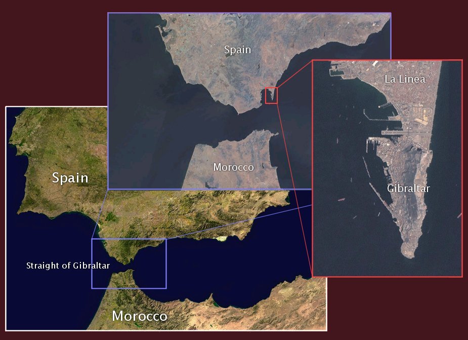 | |
|
Here you see the area of Gibraltar from space. Image courtesy of Earth Sciences and Image Analysis Laboratory, NASA Johnson Space Center. | |