 |
Tenerife: Coast west of Puerto de la Cruz seen from Mirador San Pedro |
Album Overview
Photo Index
  |
|
More photos in the vicinity: View from Mirador de San Pedro Harbour Mole of Puerto de la Cruz Main Church of Puerto de la Cruz |
 |
|
|
Date: Feb 03, 2004 Longitude: -16° 35.64' Latitude: 28° 23.75'  
Show Photo Position in Google Maps |
||
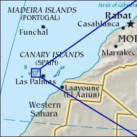  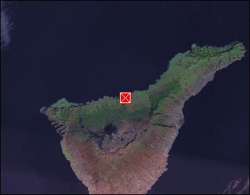 Map references: left: courtesy CIA, middle: courtesy Cicar, right: courtesy NASA. This page has been updated on: 2007-Nov-08 |
||